Precision Aerial Imaging & Geospatial Data
Successful aerial data acquisition demands more than just an aircraft; it requires meticulous mission planning, precise sensor integration, and navigating complex regulatory approvals. Helicopters Over Burlington streamlines this entire process. We analyze your specific data or footage requirements, coordinate the ideal aircraft for that operational profile, and manage all necessary flight planning and permits for your project in the Burlington area. You gain a single point of accountability for a seamless, turnkey solution, delivering accurate results efficiently.
Cinema & Broadcast Videography
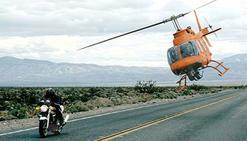
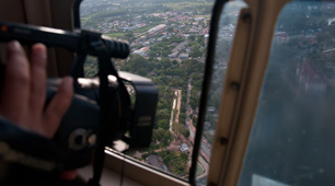
For high-end aerial cinematography, we provide access to stable, high-performance platforms essential for Directors of Photography. Whether for feature films, commercials, or live broadcast events around Burlington, our services support industry-standard stabilization systems such as Shotover, Cineflex, and Tyler Mounts. We ensure seamless coordination with your production crew, delivering precise flight paths for critical shot execution and unparalleled visual results.
Aerial Photography
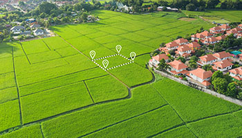
Capture high-resolution marketing assets, compelling real estate portfolios, and crucial progress documentation. We facilitate professional aerial photography services, leveraging expertise in lighting, angles, and composition to deliver magazine-quality stills that elevate your brand and projects in the Burlington region.
LiDAR & Geospatial Surveying
Beyond basic visuals, we deliver actionable data. We conduct LiDAR acquisitions, orthomosaic mapping, and 3D terrain modeling. These services are vital for urban planning, utility inspections across Chittenden County, and environmental monitoring initiatives.
Utility & Asset Inspection
We provide rapid, detailed inspection of transmission lines, pipelines, and cell towers. The stable hover and flight precision offered ensure high-fidelity asset auditing, crucial for maintaining critical infrastructure around Vermont.
Technical FAQ
Our platforms are configured for all major industry mounts, including Shotover (F1, K1), Cineflex, and Wescam. For lighter cinema payloads, we also support Tyler Minigyro and Middle mounts, offering versatile aerial capabilities.
Yes, we manage all necessary airspace authorizations and flight plans for urban operations. Experienced pilots skillfully navigate complex controlled airspace, ensuring your required aerial visuals are captured legally and safely throughout the Burlington metropolitan area.
We offer flexible solutions, providing an expert sensor operator or flying your creative team. If your crew joins us, they will receive comprehensive briefings on safety and effective air-to-ground coordination protocols.
Depending on the sensor payload, we deliver raw point clouds (LAS/LAZ), orthomosaic maps (TIFF/ECW), or processed 3D meshes. We work directly with your GIS team to ensure complete file compatibility and seamless data integration.
Gallery
Aerial Photography
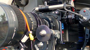
Camera Equipment
Camera Mounts
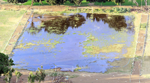
Damage Survey
Real Estate Survey
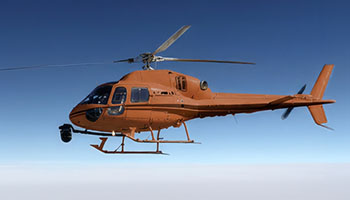
Aerial Videography
Complete Aerial Photography and Videography Solutions
Call Helicopters Over Burlington at 1-855-445-8965 for a fast, complimentary quote for helicopter aerial photography services right here in Burlington.